The map of the United States of America is not just a geographical layout—it is a timeline of exploration, conflict, negotiation, and expansion. From thirteen original colonies hugging the Atlantic coast to the vast 50-state expanse we know today, the USA map has undergone dramatic transformations. This article takes you on a visual journey through the history of how the USA map evolved.
Table of Contents
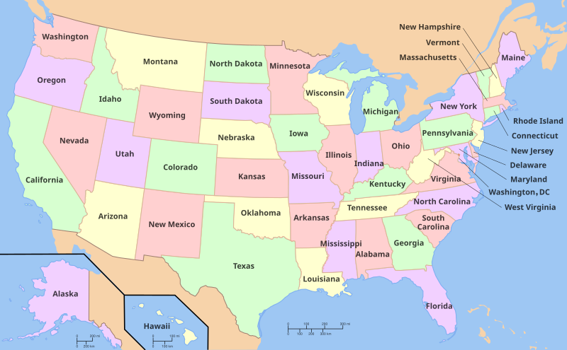
Toggle🗺️ The Original Thirteen Colonies (1776)
When the United States declared independence from Great Britain in 1776, it consisted of 13 colonies along the Atlantic coast:
-
New Hampshire
-
Massachusetts
-
Rhode Island
-
Connecticut
-
New York
-
New Jersey
-
Pennsylvania
-
Delaware
-
Maryland
-
Virginia
-
North Carolina
-
South Carolina
-
Georgia
These colonies declared themselves as independent states and formed the first official U.S. map, showing a young nation confined to the East Coast.
📜 The Treaty of Paris (1783)
After the American Revolutionary War, the Treaty of Paris was signed in 1783. This treaty granted the U.S. territory east of the Mississippi River, effectively doubling the size of the country.
-
Included new lands: Ohio, Indiana, Illinois, Michigan, Wisconsin
-
Known as the Northwest Territory
-
Marked the beginning of westward expansion
💰 The Louisiana Purchase (1803)
One of the most significant moments in American map history was the Louisiana Purchase in 1803.
-
Purchased from France for $15 million
-
Doubled the size of the U.S. again
-
Included land from the Mississippi River to the Rocky Mountains
-
Modern-day states: Arkansas, Missouri, Iowa, Minnesota (part), North Dakota, South Dakota, Nebraska, Kansas, Oklahoma, and parts of Colorado, Montana, Wyoming, and Louisiana
Fun Fact: President Thomas Jefferson made the purchase without explicit Congressional approval—an unprecedented move at the time!
🌄 Lewis and Clark Expedition (1804–1806)
To explore the newly acquired land, Jefferson commissioned Lewis and Clark to chart the territory. Their maps:
-
Provided the first detailed look at the American West
-
Helped boost migration and settlement
-
Confirmed the potential for expansion to the Pacific
📦 The Addition of Florida (1819)
Florida was ceded to the U.S. by Spain through the Adams-Onís Treaty in 1819.
-
Became a U.S. territory in 1821
-
Officially a state by 1845
-
Solidified the southeastern border of the country
🗻 The Oregon Trail and the Oregon Territory (1846)
As settlers moved west, the U.S. and Britain jointly occupied the Oregon Territory. In 1846, the Oregon Treaty granted the U.S. sole ownership of:
-
Oregon
-
Washington
-
Idaho
-
Parts of Montana and Wyoming
The map now showed a nation stretching from Atlantic to Pacific.
🗺️ Texas Annexation (1845)
The Republic of Texas was an independent country from 1836 to 1845 after breaking away from Mexico. It was annexed by the U.S. in 1845:
-
Triggered the Mexican-American War
-
Added vast territories to the southwest
-
Set the stage for further expansion
⚔️ The Mexican Cession (1848)
Following the Mexican-American War, the Treaty of Guadalupe Hidalgo granted the U.S. a massive swath of land:
-
California
-
Nevada
-
Utah
-
Most of Arizona and New Mexico
-
Parts of Colorado and Wyoming
This was known as the Mexican Cession and completed the continental U.S. as we know it today.
🛒 Gadsden Purchase (1854)
To allow for a southern transcontinental railroad, the U.S. bought land from Mexico in 1854:
-
Known as the Gadsden Purchase
-
Included southern parts of Arizona and New Mexico
-
Marked the last major territorial acquisition in the lower 48 states
🏔️ Alaska Purchase (1867)
In a surprising deal, the U.S. purchased Alaska from Russia for $7.2 million.
-
Nicknamed “Seward’s Folly” (many thought it was a bad purchase)
-
Became a state in 1959
-
Rich in natural resources
🌺 Annexation of Hawaii (1898)
The U.S. annexed the Kingdom of Hawaii in 1898 due to its strategic location in the Pacific.
-
Officially became a state in 1959
-
Marked the expansion of U.S. presence into the Pacific region
-
Finalized the current 50-state map
🇺🇸 U.S. Territories
Even today, the United States continues to administer territories that are not part of any state:
-
Puerto Rico
-
Guam
-
American Samoa
-
U.S. Virgin Islands
-
Northern Mariana Islands
While not states, these territories appear on extended versions of the USA map and are integral parts of American geography.
🧭 Timeline of U.S. Map Changes
| Year | Key Event | Territory Gained |
|---|---|---|
| 1783 | Treaty of Paris | Land east of Mississippi River |
| 1803 | Louisiana Purchase | Central U.S. |
| 1819 | Adams-Onís Treaty | Florida |
| 1845 | Texas Annexation | Texas |
| 1846 | Oregon Treaty | Pacific Northwest |
| 1848 | Treaty of Guadalupe Hidalgo | Southwest U.S. |
| 1854 | Gadsden Purchase | Southern Arizona/New Mexico |
| 1867 | Alaska Purchase | Alaska |
| 1898 | Hawaii Annexation | Hawaii |
| 1959 | Admission of Alaska & Hawaii as States | Completion of the 50-state map |
🌐 From Colonies to Superpower
The changing map of the USA is a visual record of the nation’s:
-
Growth
-
Ambition
-
Diplomacy
-
Conflict
From a fragile band of 13 states to a coast-to-coast nation and global superpower, the evolution of the U.S. map tells a compelling story of resilience and expansion.
🧠 Fun Facts
-
Only 2 states were once independent countries: Texas and Hawaii
-
The Mississippi River was once the western boundary of the U.S.
-
The U.S. map has remained unchanged in terms of state boundaries since 1959
🗺️ Conclusion
The U.S. map is more than borders and names—it’s a mirror of the nation’s past. Every change tells a story of treaties, wars, dreams, and decisions that shaped a country. Whether you’re a student, traveler, or history buff, exploring the evolution of the USA map is an enlightening way to understand American identity.